Fire crews are all over Big Sur as the Timber Fire in the north and Plaskett Fire in the south continue to burn. Containment levels of the Timber Fire improved this week, and the northern closure of Highway 1 reopened.
Now, the Big Sur Valley’s strip of businesses that were isolated on and off for weeks can open their doors. To the south, Highway 1 remains closed due to the Plaskett Fire, which started at the end of August.


While millions of visitors adventure along the 100-mile stretch of scenic coastline known as the Big Sur coast that spans from Carmel River State Beach to the Hearst Castle, the Big Sur Valley is the heart of the region.

The Valley begins 26 miles south of Carmel and is where many of the region's businesses and attractions are concentrated. The area gets hit hard during closures due to storms, landslides and forest fires.
Andrew Madsen is a public affairs officer with the U.S. Forest Service and says thousands of firefighters from almost every state, and even the U.S. Virgin Islands, are pitching in.
" There's all kinds of L.A. County people here. (I've) seen them from San Diego, Tulare, Kingston," said Madsen.
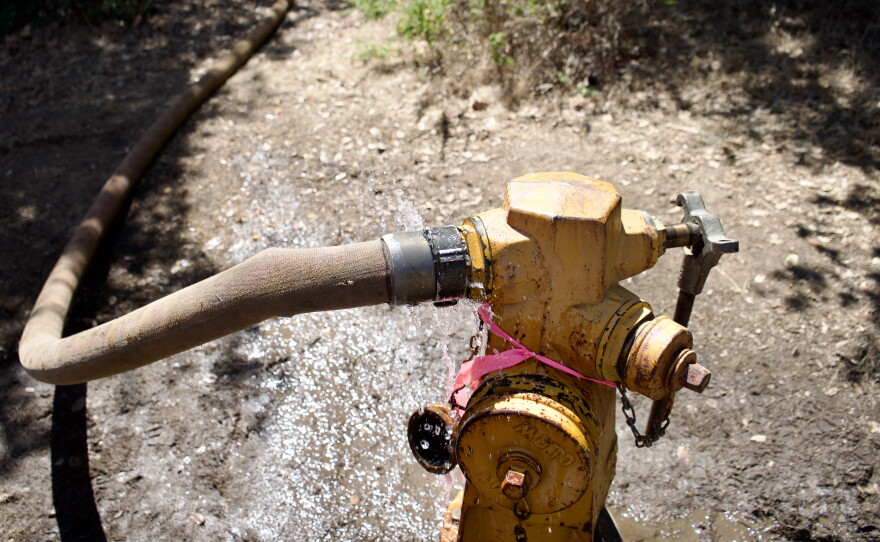
Just outside Pfeiffer Big Sur State Park, firefighters are fueling up trucks and hooking hoses up to fire hydrants that suck in thousands of gallons of water. Madsen says the terrain is dry and the topography is extremely steep.
“ I mean, it looks like an EKG readout," said Andrew Madsen, who has worked for the U.S. Forest Service for over two decades. "It's impossible to safely put firefighters in to go direct."
Firefighters rely on aircrafts to drop water and people in these remote areas and use drones to identify fire hot spots. But Madsen says the big help would be: " if we can get some rain on this thing. That's typically what puts out Big Sur fires in the backcountry.”
"A lot of the locals are really helpful," said Rusty Sexton, Battalion Chief on the Cleveland National Forest in San Diego.
Rusty Sexton is a Battalion Chief from San Diego. His birthday is on Sept. 6 — right in the middle of fire season. He’s spent 21 of his last 23 birthdays on the line, and this year won’t be different.
"So yeah, so my birthday will be here," said Sexton.
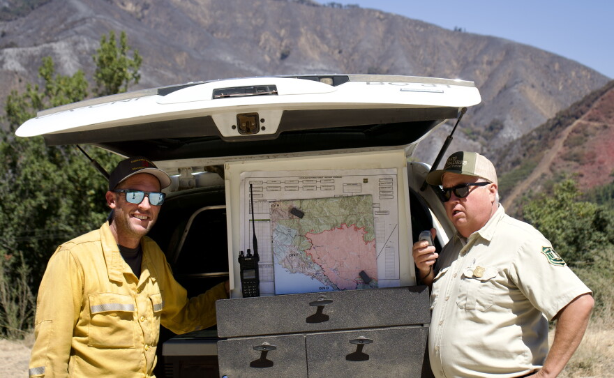
At the peak of the Timber Fire in late August, he supervised about 400 firefighters. He relies on maps to strategize the best way to fight the blaze.
And Big Sur residents, who are no stranger to wildfires, have been sharing their own maps to point out valuable structures, wells and streams.

"Last night one of the locals had all these hand-drawn maps of their community over on the north side of Big Sur," said Sexton. "They've been through it, they've seen it, and so they've got more on-the-ground information.”

Carol Shadwell is one of the folks Sexton is talking about. She owns Ripplewood Resort on Highway 1, in the heart of Big Sur. Her grandparents bought the resort in the 1950s.
She's interfaced with firefighters daily since the Timber Fire broke out on Aug. 8. Standing in her store, she and a firefighter discussed a hand drawn map her sister created.
Local maps help identify structures and water sources that might be missing from the ones firefighters are using. Shadwell’s resort was in an evacuation zone, but she never left.
"It’s my home," said Shadwell. "I haven’t left my home."
Firefighters were relying on the resort’s general store for basics, and she was renting out rooms at a discount.
"I couldn't imagine having to say, 'Oh no, oh no—you can't come in here. No. I can't sell you what you need or want," said Shadwell.
This is the fourth fire Shadwell has lived through and during the evacuation she extended store hours to accommodate firefighters.
"It's so quiet and so beautiful, but it's also eerie," she said. Once the wildfire is fully extinguished she says she'll be taking a vacation.